Natalia Domino
Advanced Cartography and Visualization
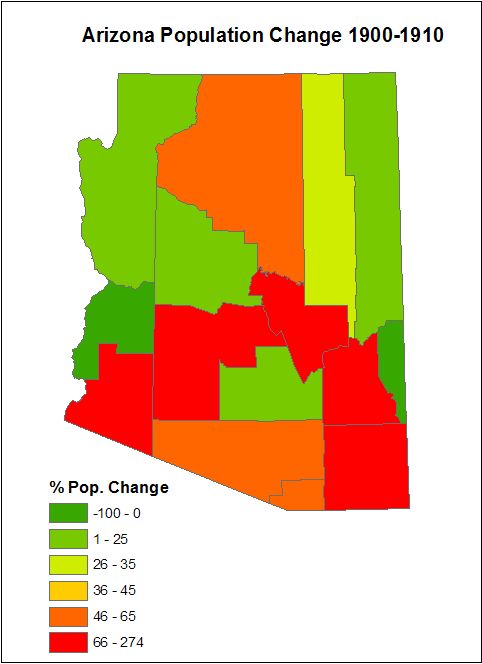
Choropleth Maps showeing the Arizona county's population change by decade
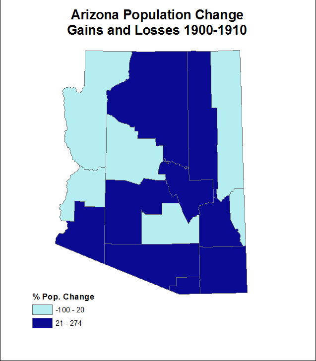
Choropleth Maps showing the population change gains and losses by decade
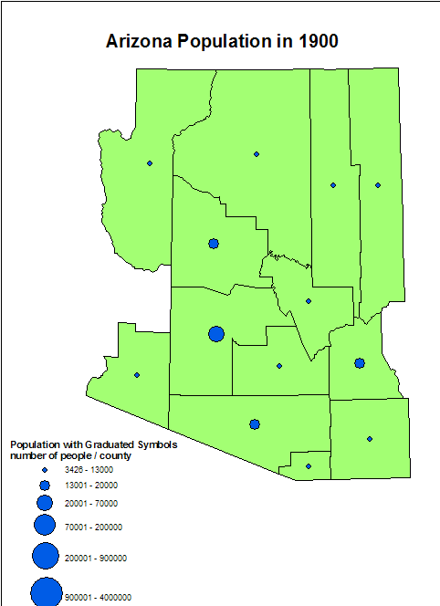
Graduated Symbol maps showing Arizona county's population by year
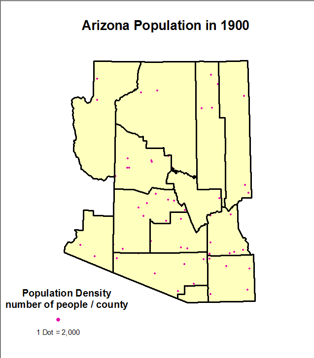
Dot Density Maps showing Arizona county's population by year
...to Natalia Domino's Home Page